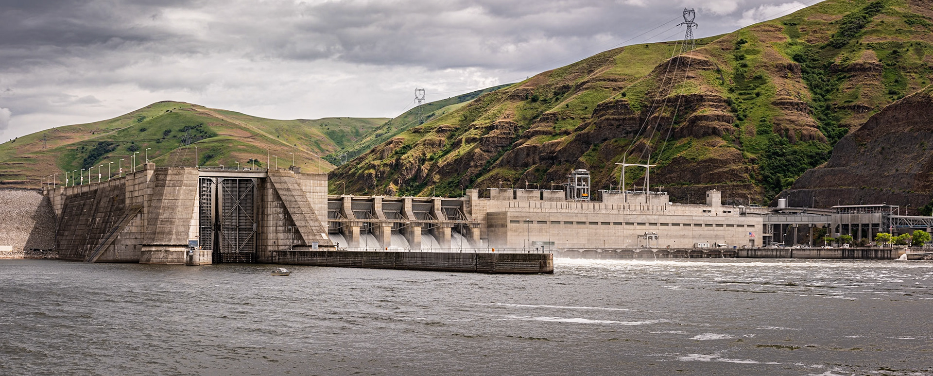
I was in the Palouse region of Washington and noticed on a map that Lower Granite Dam and Lock on the Snake River was a short drive away. It was a rainy day, so I decided the detour, even if nothing made a good image, would be interesting. I stood on the northern bank of the river for this photo, which is a panorama of three images.The bluffs on the right provide a contrasting background to the dam. They rise about 1200 feet above the river.The rated capacity of the powerhouse is 810 MW. The lock chamber has a lift of 86 feet. On the right is part of the fish chute system, which gently bypasses salmon around the dam using what is basically an oversized water-park slide.Date: 24 May 2019Location: Whitman County, Washington, United StatesOriginal resolution: 36 MPProcessing: Processed from RAW using Adobe Photoshop Lightroom Classic 10
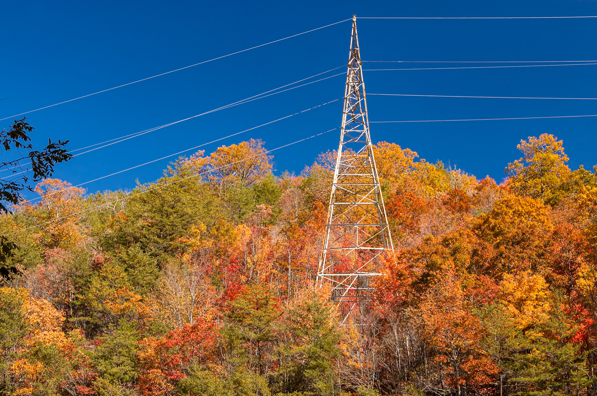
While at the Boyd Gap overlook, just south of U.S. Highway 64, I noticed this U.S. TVA high-voltage transmission tower standing amid a number of beautiful trees. The tower and power lines stand out clearly against the brilliant blue sky.Date: 4 November 2008Location: Polk County, Tennessee, United StatesOriginal resolution: 6 MPProcessing: Processed from RAW using Adobe Photoshop Lightroom Classic 10
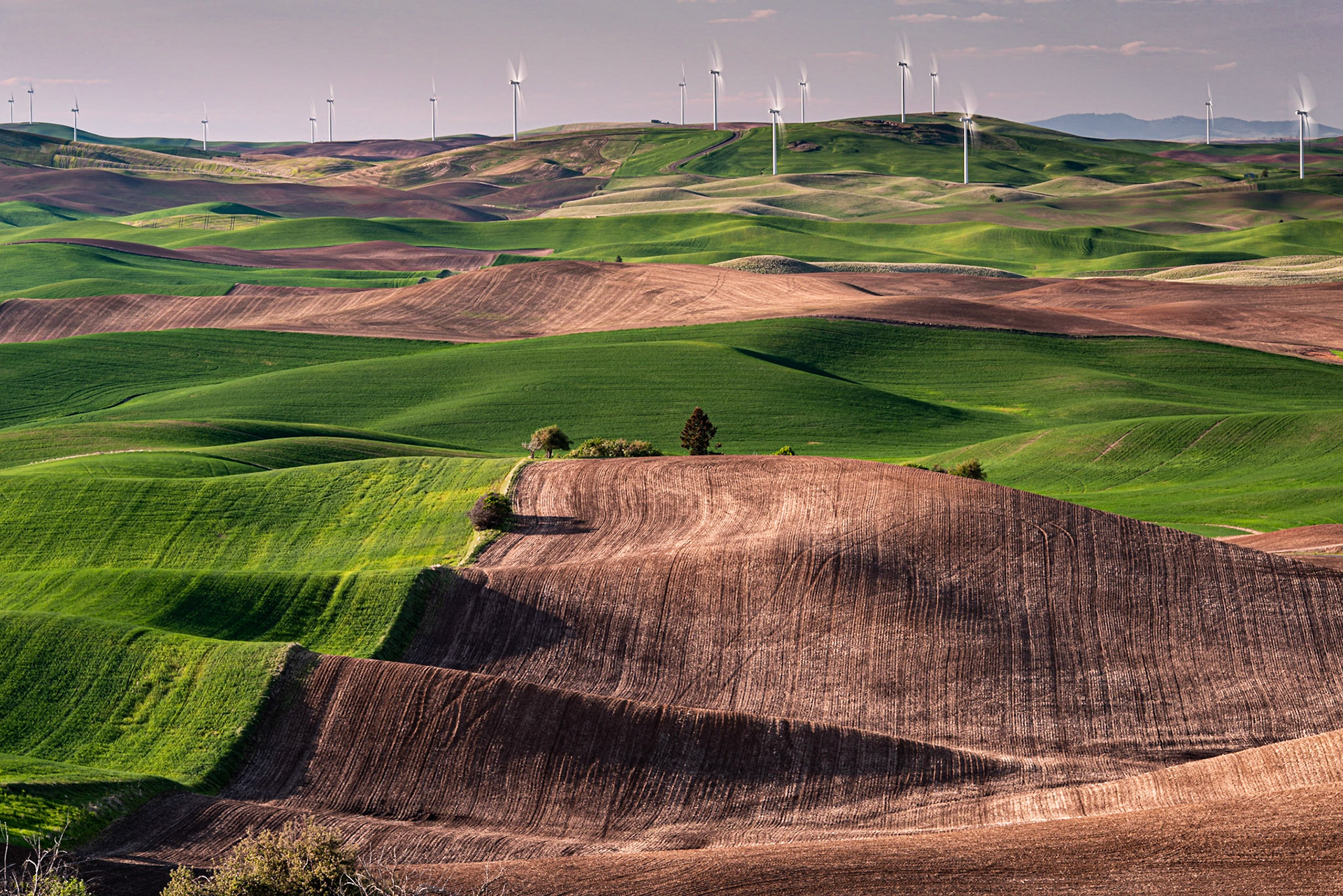
The Palouse wind farm covers a range of hills north of Steptoe Butte. I used a 3-stop neutral density filter to increase the exposure time and blur the turbine blades. The well-defined edge of the planted area versus the unplanted area provides a leading line to the wind farm.The Palouse wind farm contains 58 Vestas V-100 1.8-MW wind turbines, providing a total of 104.4 MW of electric power capacity.Date: 22 Nay 2019Location: Steptoe Butte State Park, Washington, United StatesOriginal resolution: 36 MPProcessing: Processed from RAW using Adobe Photoshop Lightroom Classic 8
Date: 12 July 2024 | Location: | Nikon Z8 | Original Resolution: 45 MP | Processed from RAW in Adobe Photoshop Lightroom Classic 13
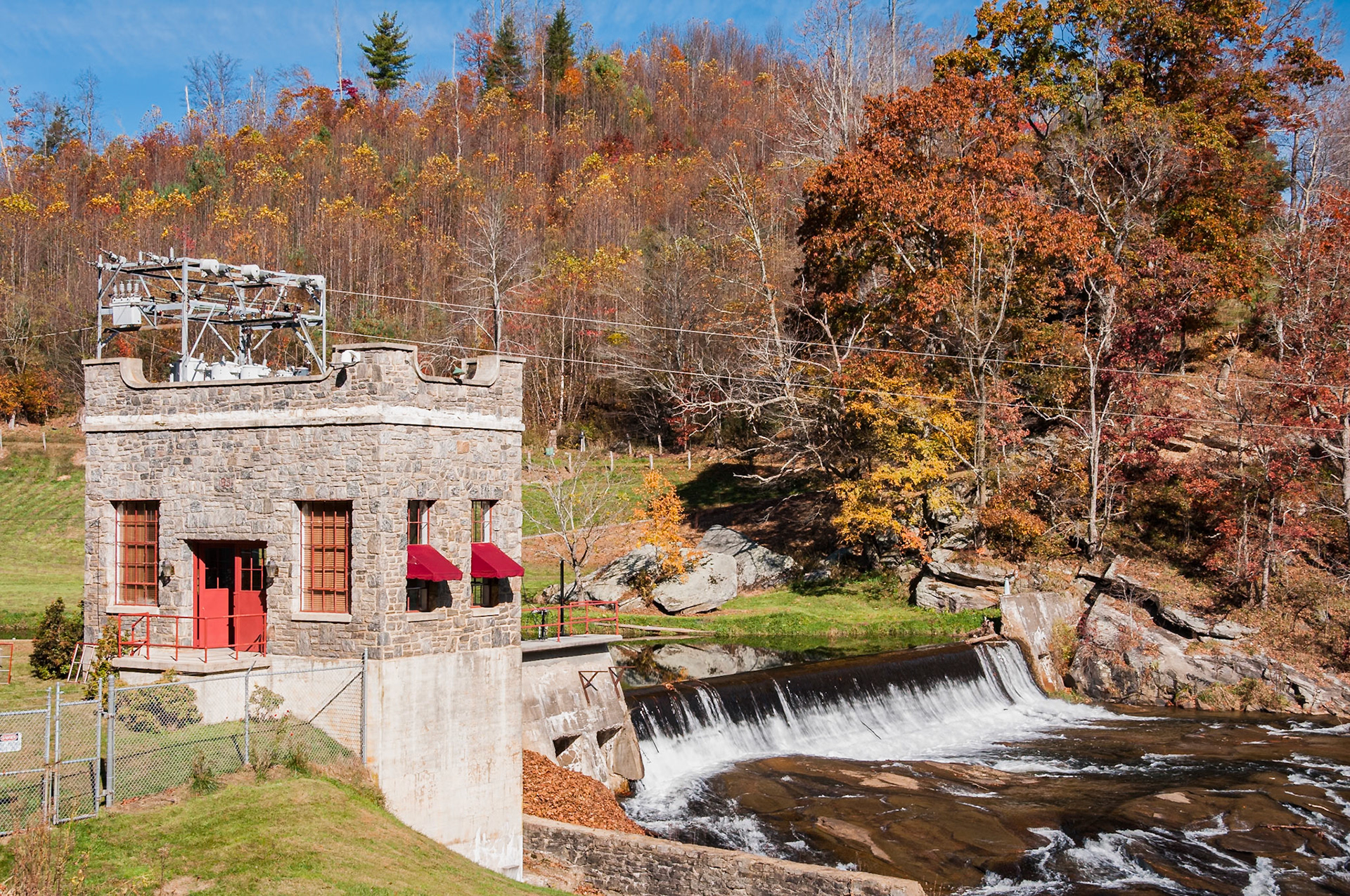
I had seen this small hydroelectric plant on the North Fork of the New River many years back, in the film days. I couldn't remember exactly where it was, but I knew what it was when we passed it on the highway.The powerhouse and dam were built in 1931. It has two Francis turbines producing a total of 200 kW of power. The power is supplied to the local electric cooperative.Date: 23 October 2012Location: Warrensville, North Carolina, United StatesOriginal resolution: 12 MPProcessing: Processed from RAW using Adobe Photoshop Lightroom 6
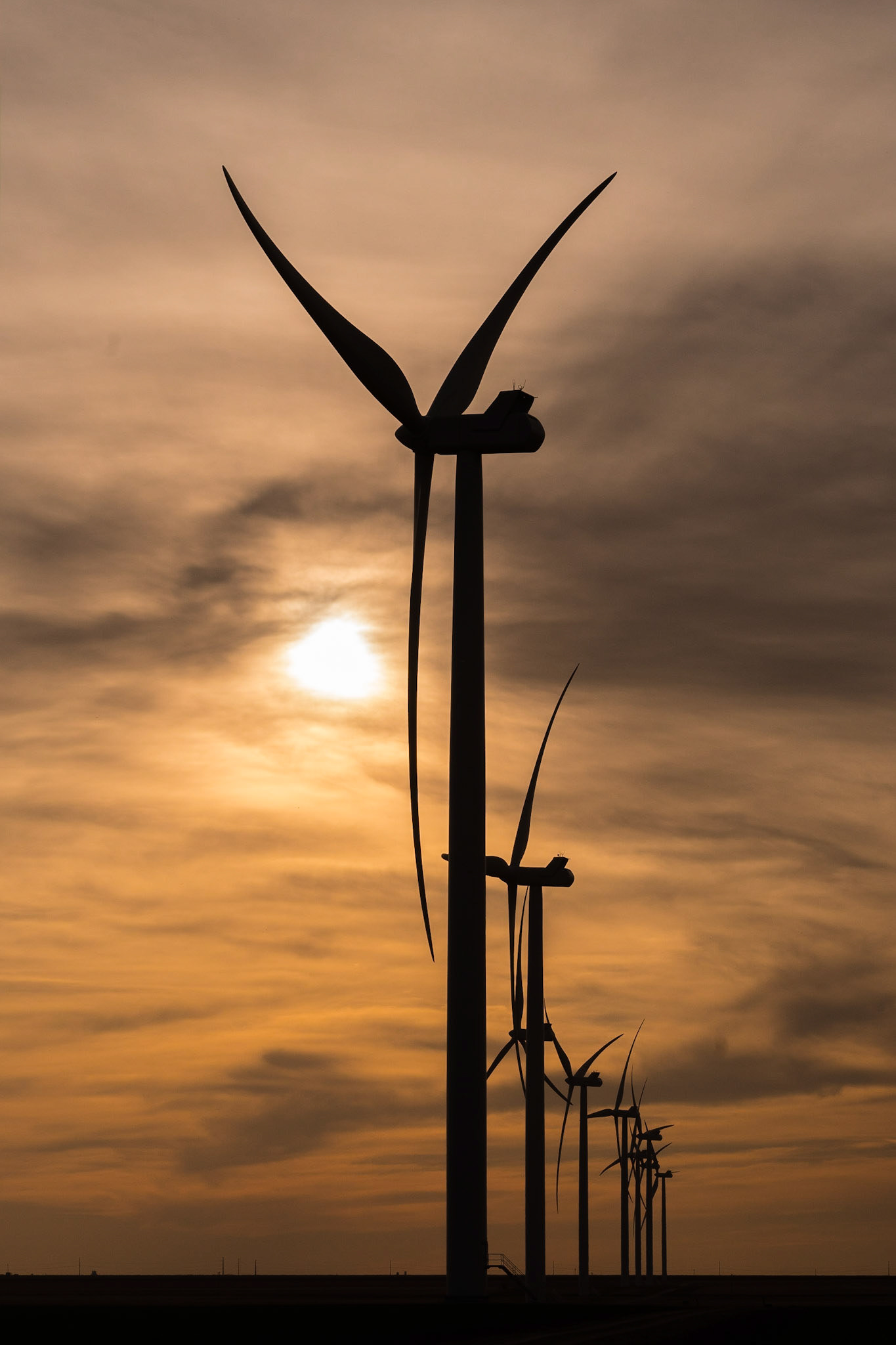
We were driving through Floyd County in the Texas Panhandle when we came across the South Plains Wind Farm. I was playing around with different angles and lenses when I discovered this particular shot, with its vanishing perspective line.Phase II of the South Plains Wind Farm in Floyd County, Texas, consists of 91 Vestas V117 3.3 MWe, 91.5-meter, wind turbine generators, producing a rated output of 300 MWe.Date: 16 March 2017Location: Floyd County, Texas, United StatesOriginal resolution: 20 MPProcessing: Processed from RAW using Adobe Photoshop Lightroom 6
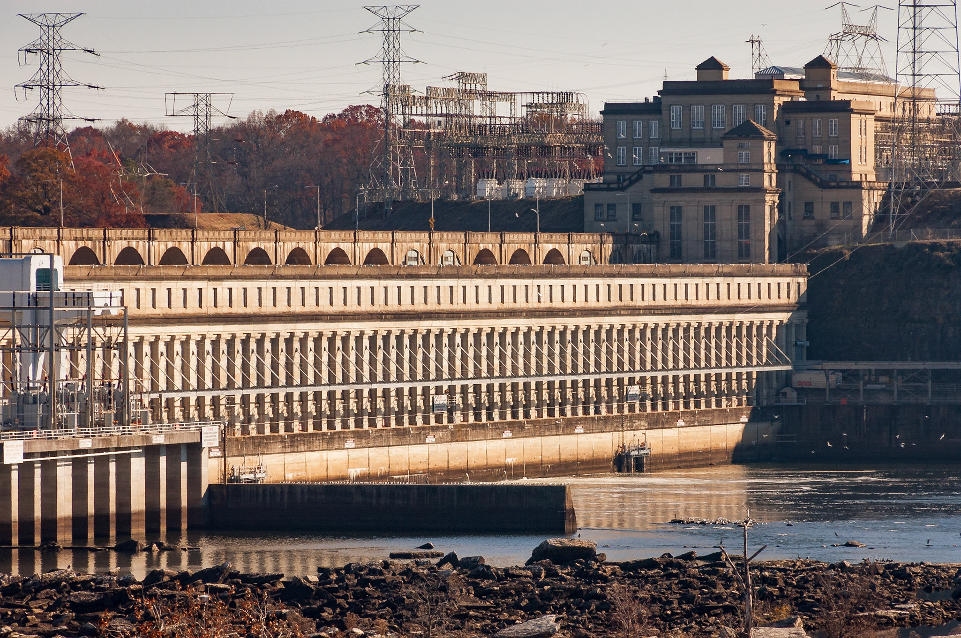
The powerhouse of the U.S. Tennessee Valley Authority's Wilson Dam spans the south end of the dam. The neoclassical style dam was the first built on the Tennessee River and dates to its completion in 1924. It was originally built to provide power to the U.S. government's nearby nitrate plants, which were built to provide ammonium nitrate for military explosives. With the TVA Act, the dam was turned over to the TVA in 1933. The powerhouse contains 21 generators totaling 663 MW of net dependable power capacity.Date: 7 December 2008Location: Florence, Alabama, United StatesOriginal resolution: 6 MPProcessing: Processed from RAW using Adobe Photoshop Lightroom 6
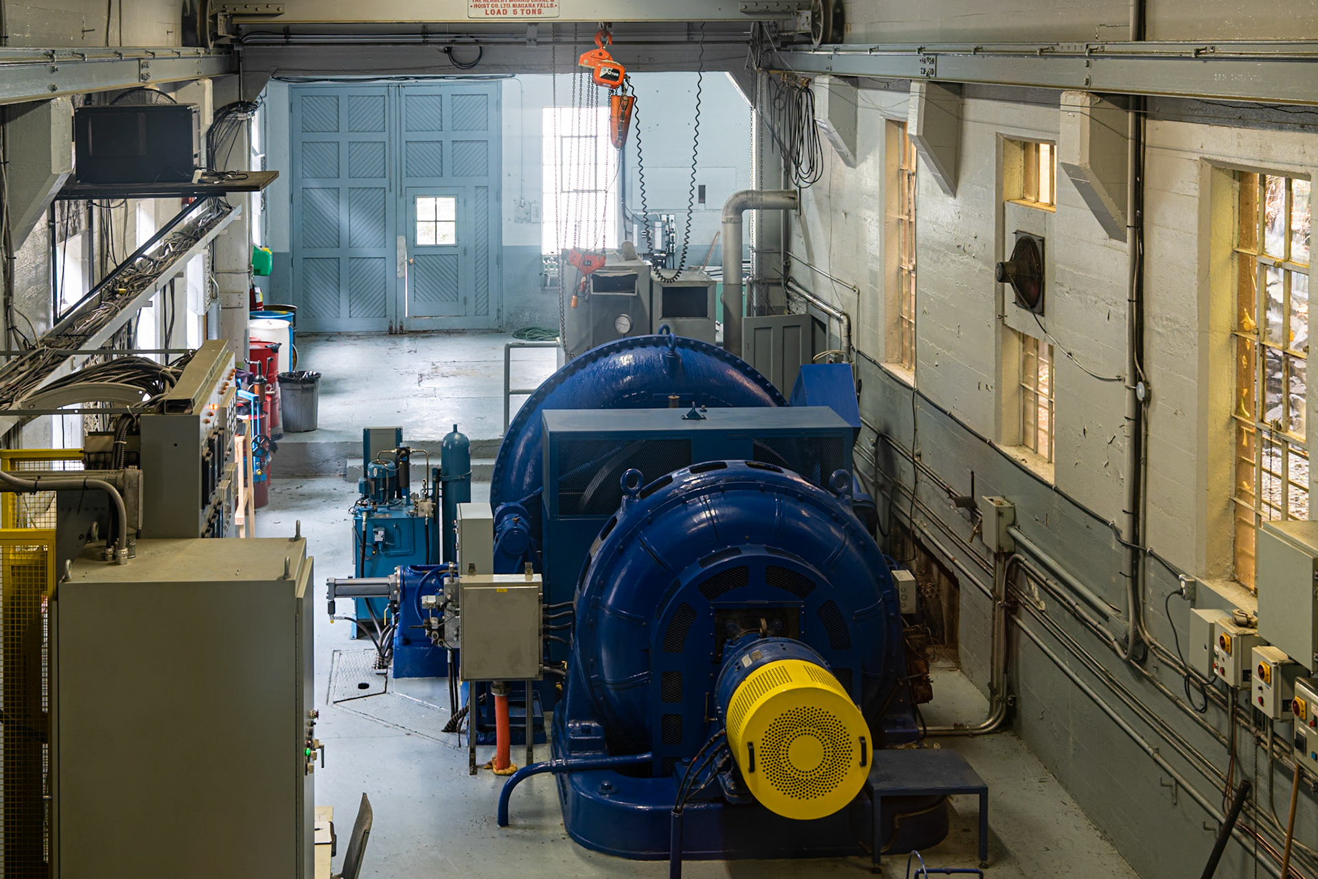
We were visiting the small Parc de la Gorge in Coaticook to view the river and fall foliage when we came upon this small hydroelectric plant. Visitors are allowed to look at the turbine and generator from a balcony.The blue machine is the generating set. The circular volute of the Franics turbine can be seen at the back of the blue machine. It spins a shaft, which turns the generator, which sits closest to the viewer. The generating set is oriented vertically, which is different from the horizontal orientation of larger hydroelectric turbines.Date: 9 October 2018Location: Coaticook, Québec, CanadaOriginal resolution: 36 MPProcessing: Processed from RAW using Adobe Photoshop Lightroom Classic 10
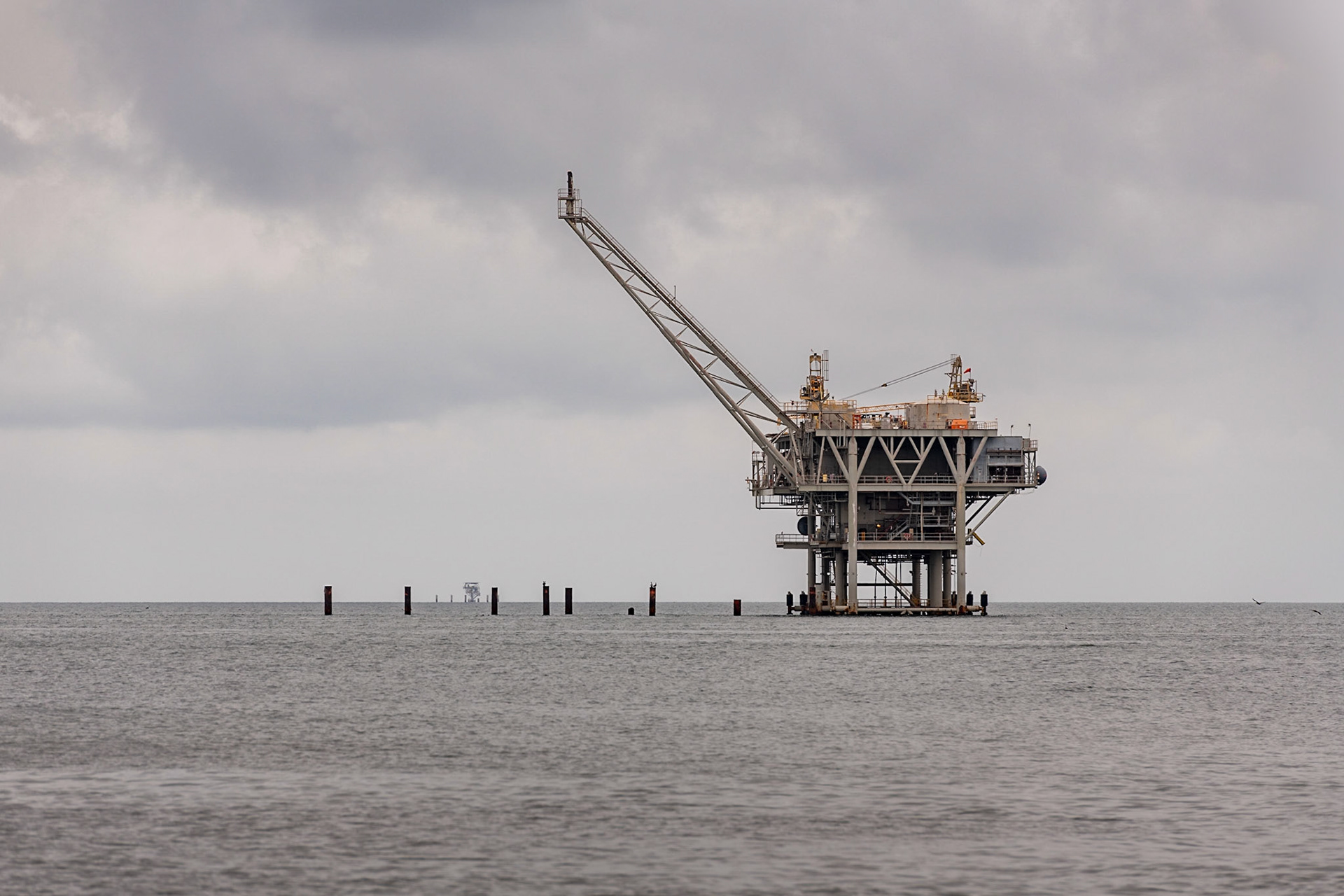
This offshore, shallow-water, fixed production plarform produces oil and gas from the Mary Ann Field in Mobile Bay. The field was orginally developed by ExxonMobil and is now owned and operated by W&T Offshore.Date: 26 June 2020Location: Fort Morgan, Alabama, United StatesOriginal resolution: 45 MPProcessing: Processed from RAW using Adobe Photoshop Lightroom Classic 9